WP1: Hydrological and climate data
Without understanding the dominant processes in the hydrologic response of a landscape it is unlikely that we are able to fully grasp landscape functioning and evolution. The hydrologic response is strongly controlled by landscape characteristics, while shaping and changing the landscape at the same time, thus producing a feedback loop until some type of steady state is reached. However, landscapes which are subject to anthropogenic intervention are rarely at or near steady state. Among the landscape characteristics that control hydrologic response are land use and land cover, geology and soils, topography and of course the dynamic climatic signal. Of special interest in this context are so-called thresholds or tipping points – system states where slight changes in the boundary conditions can result in a huge change in response characteristics, often triggering processes that are irreversible.
While dendrochronological data can give us an idea about dry and wet periods in the past 100-200 years and sediment cores contain information on sediment delivery to the lakes over even longer periods of time, we need to understand the dynamics and driving forces of water flow and water storage to relate these datasets to current conditions, put them into context and allow estimates of future development.
To this end we will instrument an extensive integrated monitoring network, to investigate the dynamics of groundwater recharge, water storage in the saturated and unsaturated zone, tree water uptake, the dynamic flow paths in the subsurface and the interaction of ground and surface water, i.e. the lake system. This will allow us to link catchment state i.e. water storage in the subsurface with flow paths and processes. Threshold conditions leading to surface runoff and sediment input into the lake can thus be investigated and hopefully linked to sediment core data.
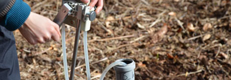
Ground- and soil water dynamics will be investigated with state of the art wireless sensor networks, in order to capture the inherent variability of the system. Tracer tests using natural and applied tracers (e.g. stable isotopes or fluorescent tracers) using automated sampling systems and in-situ analysis by multi-parameter probes and flow-through cells will provide information on flow paths and the inter-connectedness of the system. DTS (distributed temperature sensing technology using fibre optic cables) can be used to produce high spatial resolution data sets of temperature with data points every meter over the length of the cable. Installing such a fibre optic cable in the lake sediment will produce a map of lake-bottom temperature anomalies, which are often indicators of groundwater influxes. Once these anomalies are localized, influxes will be investigated further by piezometer transects and seepage meters. These groundwater influxes and their dynamics over time are then quantified with the help of water and heat transport models.
Stable isotopes will be analyzed for ground and soil water as well as lake water and precipitation. This dataset will give us information on water residence times in the subsurface (saturated and unsaturated zone) as well as in the lakes and additionally contains information on flow paths. Furthermore the isotope data will be used to identify the water sources used by the trees (where isotope data can be measured with high temporal resolution within single tree rings), whether these sources change over time and the thresholds underlying these changes. The isotope data, together with the data on subsurface water storage dynamics are therefore an important and promising link to the dendrochronological dataset. We will furthermore provide climatic data (e.g. air temperatures, relative humidity, evaporation, precipitation, wind velocities) for the other work packages.
In a next step the extensive hydrological dataset will be used to parameterize a physically based hydrological model in order to test our process hypotheses and iteratively improve our monitoring network. The model will furthermore allow us to simulate future (and also past) scenarios of both land use and climate change.